Manors, Clohars-Carnoët
Manoir de Saint-Mady
Manoir, Saint-Mady (Clohars-Carnoët)
- Town
- Clohars-Carnoët
- Type
- Manors
- Period
- 16th–19th century
- Protection
- Not listed
- Architect, author
- Cadoret (commanditaire)
- Legal status (survey)
- Private property
- Materials
- schiste, granite, moellon, pierre de taille, ardoise
- Shore
- 2.0 km
In brief
Manoir de Saint-Mady is a 16th–19th century manor in Clohars-Carnoët, southern Finistère. Materials recorded: schiste, granite, moellon, pierre de taille, ardoise. The estate includes jardin, four à pain, grange, puits. Private property. 2.0 km from the shore as the crow flies, 44.9 km from Quimper railway station and 48.9 km from Quimper-Cornouaille airport. Surveyed by the Brittany regional heritage inventory (Clohars-Carnoët, 2002).
History
Official heritage record, in French:
Le manoir est attesté en 1536. Le logis, peut-être construit pour les Cadoret dont le blason (illisible) pourrait figurer au-dessus de la porte d'entrée, date de cette époque. Le domaine seigneurial incluait au 16e siècle deux métairies (Petit Saint Mady, Kercahen), un moulin à vent (voir Kercousquet) et un colombier (disparu). Baies de l'étage et lucarnes agrandies aux 17e et 18e siècles. Déclassement précoce en ferme. Le cadran solaire daté 1810 porte l'inscription "Joseph Derrien". Corps de bâtiment est (ancienne étable à chevaux) construit au 19e siècle, à l'emplacement d'un corps de latrines (traces) qui figure sur le cadastre de 1823. Four à pain et grange probablement antérieurs à 1823. L'édifice a été restauré à partir de 1981 (restitution de la partie haute de la tour d'escalier).
Text of the Brittany regional heritage survey (Région Bretagne), record IA29000632, survey 2001, written 2002, reproduced unchanged; consulted on patrimoine.bzh on 3 November 2026.
Timeline
Dates from the official record and the sources cited, in order (in French).
- 1536Le manoir est attesté en 1536.
- 1810Le cadran solaire daté 1810 porte l'inscription "Joseph Derrien".
- 1823Corps de bâtiment est (ancienne étable à chevaux) construit au 19e siècle, à l'emplacement d'un corps de latrines (traces) qui figure sur le cadastre de 1823.
- 1981L'édifice a été restauré à partir de 1981 (restitution de la partie haute de la tour d'escalier).
Architecture
Architectural description from the regional heritage survey, in French:
Logis à plan partiellement double en profondeur avec appentis postérieur englobant des pièces secondaires et la tour d'escalier. La présence de pignons découverts peut indiquer une ancienne toiture en chaume. Gros-oeuvre en moellon de schiste d'extraction locale, partiellement enduit, à l'exception de l'encadrement des baies, en granite. L'escalier en vis est en pierre entre le rez-de-chaussée et l'étage et en bois entre l'étage et les combles.
Text of the Brittany regional heritage survey (Région Bretagne), record IA29000632, survey 2001, written 2002, reproduced unchanged; consulted on patrimoine.bzh on 3 November 2026.
The estate
As recorded by the regional heritage survey.
- Designation
- manoir
- Component parts
- jardin, four à pain, grange, puits
- Detailed dating
- 1ère moitié 16e siècle
From the air
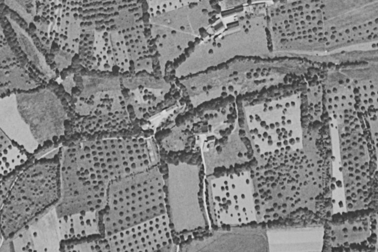
The same place, same framing: aerial photographs from the 1950s and today, centred on the footprint recorded by the heritage survey or on the record’s location.

The site through old maps
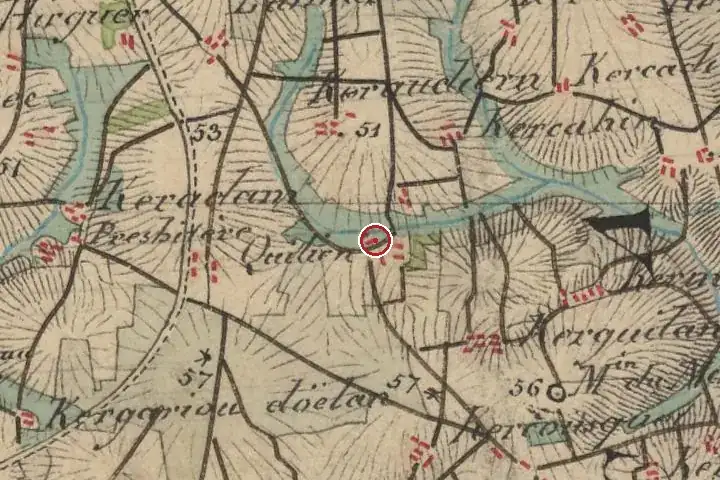
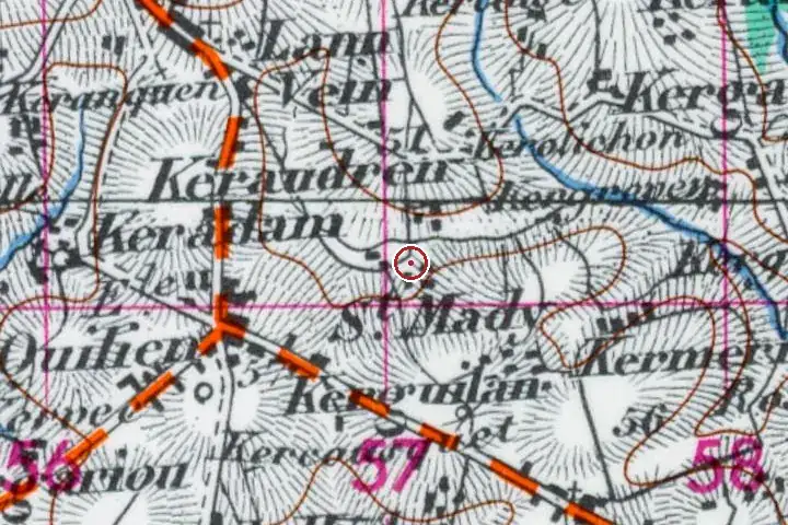
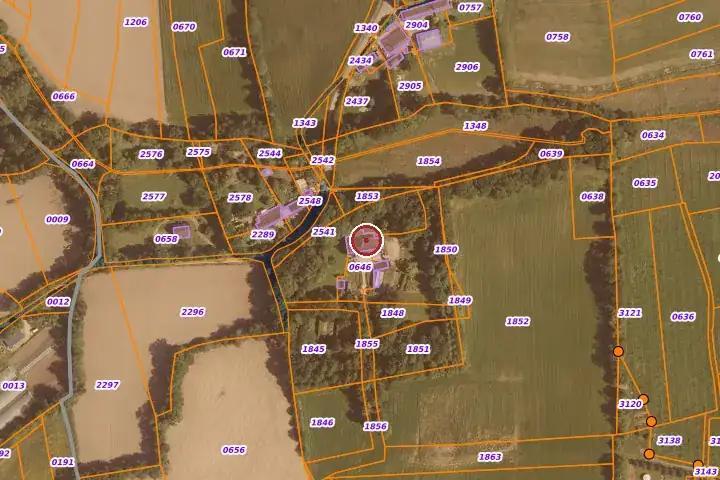
Three centuries of mapping, same centre: the red marker shows the location given by the record. Old place names, roads and woodland can be read on the Cassini and staff maps.

Further reading
References and official records.
- Dossier d’Inventaire IA29000632, Région Bretagne
- A.D. Finistère, (3 P 101). Extrait du cadastre de 1823, section G2 dite du bourg, échelle 1/2500. De Foresta, préfet, Andouy, maire, Dessaux et Azémar, géomètres.
- CALVEZ, Nathalie. Les manoirs dans la châtellenie de Quimperlé, d´une réformation à l´autre (1426-1536). Mém. D.E.A. : Hist. : Brest, Université de Bretagne occidentale, centre de Recherches Bretonnes et Celtiques : 1991 [inédit ; dactylographié].
- Le Patrimoine des communes du Finistère (Collection Le Patrimoine des Communes de France). Charenton-le-Pont : Flohic Editions, 1998, t. I, p. 1332
- INVENTAIRE GENERAL DES MONUMENTS ET DES RICHESSES ARTISTIQUES DE LA FRANCE. Région Bretagne. Quimperlé et son canton. Images du Patrimoine , n° 217, Rennes, 2002.
Around the house
House sales 2021–2025 within a radius of the record’s location (DGFiP land registry, single houses with known floor area). These figures describe the neighbourhood, never the house itself.
| Sales | Median price | Median €/m² | Median size | |
|---|---|---|---|---|
| Within 1 km | 84 | €260,000 | €2,754 | 97 m² |
| Within 3 km | 273 | €300,000 | €2,966 | 104 m² |
The local market
Aggregated town figures. Ti Kaer never links a named house to a sale price.
The sea-view premium in Clohars-Carnoët
Median price per m² of houses sold by distance to the shore, 2021-2025, all houses.
Other dossiers in Clohars-Carnoët
All dossiers


Questions
Can Manoir de Saint-Mady be visited?
No: it is a private property and cannot be visited, except for occasional openings announced by the owners.
How old is Manoir de Saint-Mady?
The oldest recorded parts date from the 16th–19th century.
Is Manoir de Saint-Mady a listed building?
No. It is neither listed nor classified as a historic monument according to the databases consulted; it appears in the regional heritage inventory, which carries no constraint.
How far is Manoir de Saint-Mady from the sea?
2.0 km from the shore as the crow flies. Quimper station is 44.9 km away and Quimper-Cornouaille airport 48.9 km.
Most of these houses are private homes and cannot be visited unless stated otherwise. No address is published.
A great house cannot be valued online.
A written valuation, prepared after a visit from comparable sales, for your eyes only. No publicity, no commitment.
Request a valuationHouses, before they are published.
Join the buyers’ list and receive, according to your search, the properties entrusted to us before they go online. In English or French.
Join the buyers’ listSources: regional heritage survey; Brittany regional heritage survey, Région Bretagne, record IA29000632 (patrimoine.bzh), open licence for the data, texts reproduced unchanged; distances computed from IGN municipal boundaries (Admin Express, open licence). Photographs: Wikimedia Commons, under the licence stated in each caption. Aerial views: IGN, open licence. Market: DGFiP land registry data, aggregated. Old maps and land registry: IGN, BnF, DGFiP, open licence. Additional facts: websites cited, consulted on 3 November 2026. No data on current owners.